
Soubor:EB 1911 Map Fig 3.png
Velikost tohoto náhledu: 604 × 599 pixelů. Jiná rozlišení: 242 × 240 pixelů | 484 × 480 pixelů | 774 × 768 pixelů | 1 072 × 1 064 pixelů.
Původní soubor (1 072 × 1 064 pixelů, velikost souboru: 816 KB, MIME typ: image/png)
| Tento soubor pochází z Wikimedia Commons. Níže jsou zobrazeny informace, které obsahuje jeho tamější stránka s popisem souboru. |
Popis
| Popis |
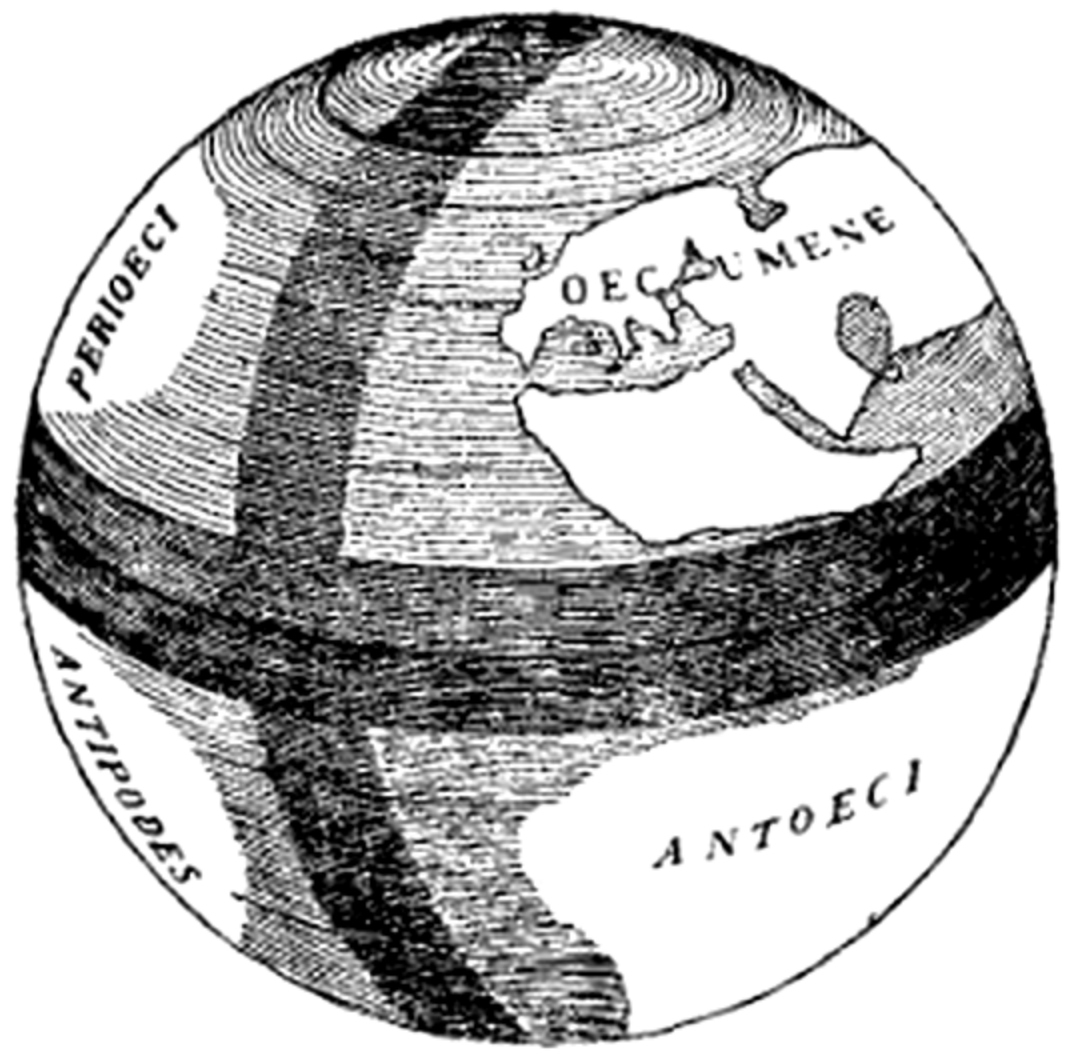
English: Caption: "Fig. 2.—The Globe of Crates of Mallus." An illustration of the globe demonstrated by Crates in Rome, displaying the oecumene (the known world of Europe, Asia, and Cissaharan Africa), perioeci (the unknown land hypothesized to lie on the other side of the Northern Hemisphere), antoeci (the unknown land hypothesized to lie on the other side of the equator, inaccessible owing to the presumed impossible heat), and antipodes (the unknown land hypothesized to lie on the opposite side of the world, likewise inaccessible). The caption describes it as "Fig. 2", but it is actually the third figure in the article. |
| Datum | cca 1911 |
| Zdroj | "Map" in the Encyclopaedia Britannica, 11th ed., Vol. XVII, p. 635. |
| Autor | Anonymous. Presumably Emery Walker. |
Licence
Toto dílo je ve Spojených státech volným dílem. To platí pro americká díla, jejichž autorská práva vypršela, často proto, že byla poprvé zveřejněna před 1. lednem 1929. Podívejte se na tuto stránku pro další vysvětlení.
|
 | |
 |
Tento obrázek nemusí být volným dílem mimo Spojené státy; to se týká zvláště těch zemí a oblastí, kde pro americká díla neplatí pravidlo kratší doby, jako jsou Kanada, Kontinentální Čína (ne Hong Kong nebo Macao), Německo, Mexiko a Švýcarsko. Tvůrce a rok publikace jsou nezbytné informace a musí být uvedeny. Viz Wikipedie:Autorské právo pro více informací.
|
| This image comes from the 13th edition of the Encyclopædia Britannica or earlier. The copyrights for that book have expired in the United States because the book was first published in the US with the publication occurring before January 1, 1929. As such, this image is in the public domain in the United States. |  |
Historie souboru
Kliknutím na datum a čas se zobrazí tehdejší verze souboru.
| Datum a čas | Náhled | Rozměry | Uživatel | Komentář | |
|---|---|---|---|---|---|
| současná | 29. 3. 2015, 06:31 | | 1 072 × 1 064 (816 KB) | LlywelynII | User created page with UploadWizard |
Využití souboru
Tento soubor používá následující stránka:
Globální využití souboru
Tento soubor využívají následující wiki:
- Využití na en.wikipedia.org
- Využití na en.wikisource.org
- Využití na es.wikipedia.org
- Využití na ru.wikipedia.org
- Využití na ru.wiktionary.org
- Využití na uk.wikipedia.org
- Využití na zh.wikipedia.org