
Soubor:Slovenia map.png
Původní soubor (2 466 × 1 890 pixelů, velikost souboru: 1,59 MB, MIME typ: image/png)
| Tento soubor pochází z Wikimedia Commons. Níže jsou zobrazeny informace, které obsahuje jeho tamější stránka s popisem souboru. |
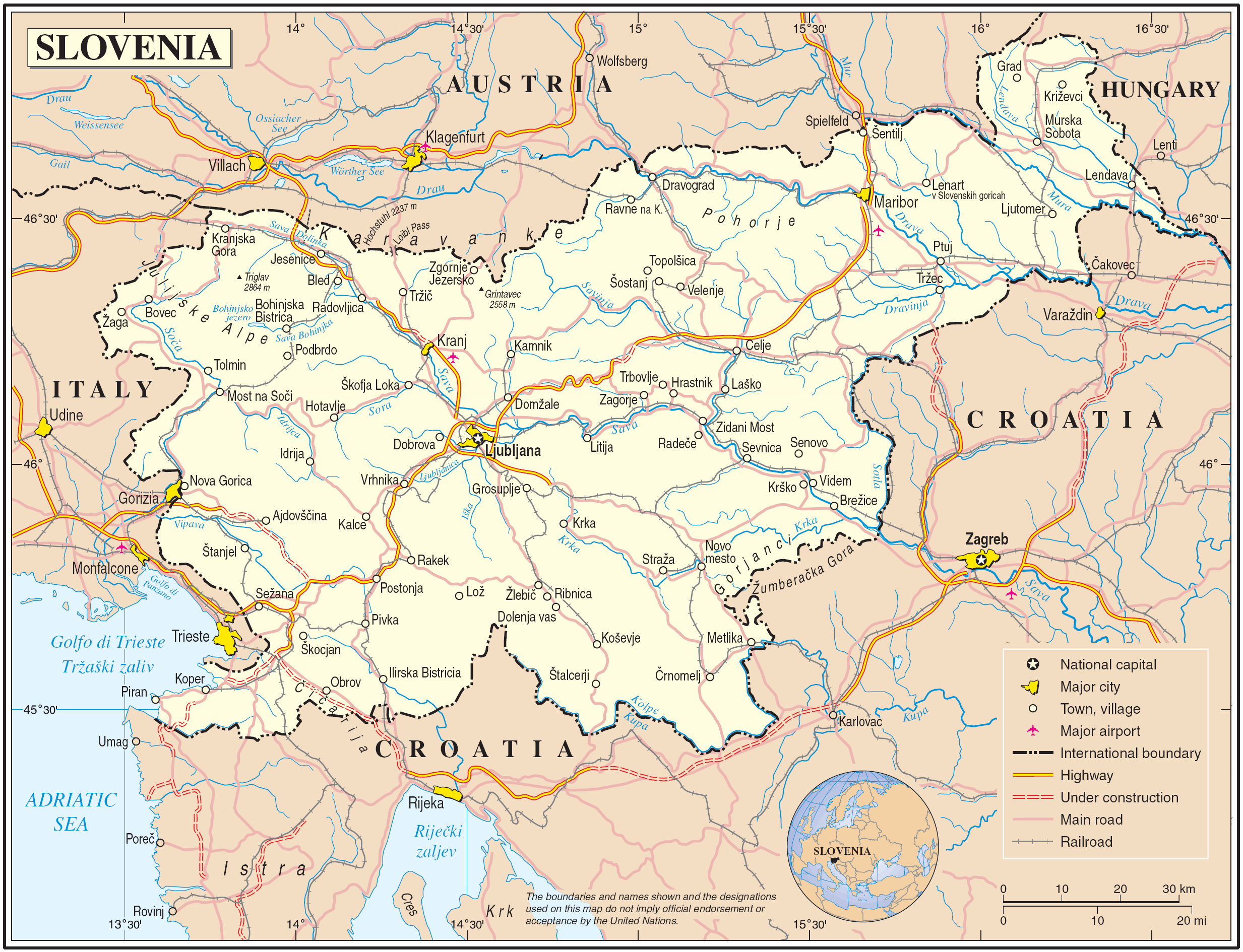
Map of Slovenia
| Popis | Map of Slovenia | |||
| Datum | June 2004 (uploaded to wikimedia 2007-03-10) | |||
| Zdroj | The Cartographic Section of the United Nations (CSUN) | |||
| Autor | Cartographer of the United Nations | |||
| Svolení (Užití tohoto souboru) |
|

Historie souboru
Kliknutím na datum a čas se zobrazí tehdejší verze souboru.
| Datum a čas | Náhled | Rozměry | Uživatel | Komentář | |
|---|---|---|---|---|---|
| současná | 11. 3. 2007, 01:42 | | 2 466 × 1 890 (1,59 MB) | Gugganij | |
| 10. 3. 2007, 19:05 |  | 2 466 × 1 890 (1,59 MB) | Minestrone | Map of Slovenia {{Information |Description=Map of Slovenia |Source=The Cartographic Section of the United Nations (CSUN) |Date=2007-03-10 |Author=Cartographer of the United Nations |Permission={{Template:UN map}} and the cartographer of the UN [mail |
Využití souboru
Tento soubor používají následující 2 stránky:
Globální využití souboru
Tento soubor využívají následující wiki:
- Využití na als.wikipedia.org
- Využití na avk.wikipedia.org
- Využití na azb.wikipedia.org
- Využití na da.wikipedia.org
- Využití na de.wikipedia.org
- Využití na el.wikipedia.org
- Využití na en.wikipedia.org
- Využití na fa.wikipedia.org
- Využití na fr.wikipedia.org
- Využití na gag.wikipedia.org
- Využití na gd.wikipedia.org
- Využití na gom.wikipedia.org
- Využití na hr.wikipedia.org
- Využití na hu.wikipedia.org
- Využití na it.wikipedia.org
- Využití na ko.wikipedia.org
- Využití na lb.wikipedia.org
- Využití na lfn.wikipedia.org
- Využití na mzn.wikipedia.org
- Využití na nl.wikipedia.org
- Využití na pl.wiktionary.org
- Využití na ps.wikipedia.org
- Využití na sl.wikipedia.org
- Využití na to.wikipedia.org
- Využití na tr.wiktionary.org
- Využití na uk.wikipedia.org
- Využití na uk.wiktionary.org
- Využití na www.wikidata.org