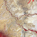
Soubor:Four Corners, Southwestern U.S.jpg

Velikost tohoto náhledu: 600 × 600 pixelů. Jiná rozlišení: 240 × 240 pixelů | 480 × 480 pixelů | 768 × 768 pixelů | 1 024 × 1 024 pixelů | 2 200 × 2 200 pixelů.
Původní soubor (2 200 × 2 200 pixelů, velikost souboru: 2,73 MB, MIME typ: image/jpeg)
Historie souboru
Kliknutím na datum a čas se zobrazí tehdejší verze souboru.
| Datum a čas | Náhled | Rozměry | Uživatel | Komentář | |
|---|---|---|---|---|---|
| současná | 26. 9. 2011, 10:35 |  | 2 200 × 2 200 (2,73 MB) | Originalwana | {{Information |Description ={{en|1=Satellite image of the Four Corners. Vegetation is red, and sparsely vegetated or bare areas range from off-white to gray to tan. Water appears navy blue to nearly black. Vegetation (bright red |
Využití souboru
Tento soubor používá následující stránka:
Globální využití souboru
Tento soubor využívají následující wiki:
- Využití na ar.wikipedia.org
- Využití na arz.wikipedia.org
- Využití na ca.wikipedia.org
- Využití na en.wikipedia.org
- Využití na eo.wikipedia.org
- Využití na es.wikipedia.org
- Využití na fa.wikipedia.org
- Využití na fr.wikipedia.org
- Využití na he.wikipedia.org
- Využití na hy.wikipedia.org
- Využití na it.wikivoyage.org
- Využití na ja.wikipedia.org
- Využití na ro.wikipedia.org
- Využití na www.wikidata.org


