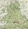
Soubor:Fürstentum Regensburg 1807.jpg

Velikost tohoto náhledu: 591 × 599 pixelů. Jiná rozlišení: 237 × 240 pixelů | 473 × 480 pixelů | 792 × 803 pixelů.
Původní soubor (792 × 803 pixelů, velikost souboru: 509 KB, MIME typ: image/jpeg)
Historie souboru
Kliknutím na datum a čas se zobrazí tehdejší verze souboru.
| Datum a čas | Náhled | Rozměry | Uživatel | Komentář | |
|---|---|---|---|---|---|
| současná | 27. 5. 2015, 03:34 |  | 792 × 803 (509 KB) | Lubiesque | User created page with UploadWizard |
Využití souboru
Tento soubor používá následující stránka:
Globální využití souboru
Tento soubor využívají následující wiki:
- Využití na br.wikipedia.org
- Využití na de.wikipedia.org
- Využití na en.wikipedia.org
- Využití na es.wikipedia.org
- Využití na fi.wikipedia.org
- Využití na fr.wikipedia.org
- Využití na it.wikipedia.org
- Využití na ja.wikipedia.org
- Využití na mk.wikipedia.org
- Využití na nl.wikipedia.org
- Využití na vi.wikipedia.org
- Využití na zh.wikipedia.org
