
Soubor:Central African Republic sub-prefectures.png

Velikost tohoto náhledu: 800 × 486 pixelů. Jiná rozlišení: 320 × 194 pixelů | 640 × 389 pixelů | 1 025 × 623 pixelů.
Původní soubor (1 025 × 623 pixelů, velikost souboru: 19 KB, MIME typ: image/png)
| Tento soubor pochází z Wikimedia Commons. Níže jsou zobrazeny informace, které obsahuje jeho tamější stránka s popisem souboru. |

|
This map has been uploaded by Electionworld from en.wikipedia.org to enable the |
Popis
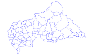
Map of the sub-prefectures of the Central African Republic. Created by Rarelibra 17:58, 31 March 2006 (UTC) for public domain use. Created using MapInfo Professional v7.5 and various mapping resources.
Licence
| Já, autor tohoto díla, jej tímto uvolňuji jako volné dílo, a to celosvětově. V některých zemích to není podle zákona možné; v takovém případě: Poskytuji komukoli právo užívat toto dílo za libovolným účelem, a to bezpodmínečně s výjimkou podmínek vyžadovaných zákonem. |
Historie souboru
Kliknutím na datum a čas se zobrazí tehdejší verze souboru.
| Datum a čas | Náhled | Rozměry | Uživatel | Komentář | |
|---|---|---|---|---|---|
| současná | 3. 6. 2022, 11:36 | | 1 025 × 623 (19 KB) | Borysk5 | Blue color |
| 2. 6. 2022, 19:39 |  | 1 025 × 624 (20 KB) | Borysk5 | Updated map | |
| 27. 11. 2006, 21:19 |  | 1 025 × 624 (18 KB) | Electionworld | {{ew|en|Rarelibra}} == Summary == Map of the sub-prefectures of the Central African Republic. Created by Rarelibra 17:58, 31 March 2006 (UTC) for public domain use. Created using MapInfo Professional v7.5 and various mapping resources. |
Využití souboru
Tento soubor používá následující stránka:
Globální využití souboru
Tento soubor využívají následující wiki:
- Využití na ca.wikipedia.org
- Využití na en.wikipedia.org
- Bangui
- Mobaye
- Bria, Central African Republic
- Obo
- Sibut
- Mbaïki
- Bambari
- Kaga-Bandoro
- Bangassou
- Bouar
- Berbérati
- N'Délé
- Kabo
- Alindao
- Batangafo
- Baoro
- Bimbo, Central African Republic
- Birao
- Boali
- Bossangoa
- Bozoum
- Boda, Lobaye
- Bouca
- Damara, Central African Republic
- Carnot, Central African Republic
- Nola, Central African Republic
- Rafaï
- Mongoumba
- Ouadda
- Ippy
- Kouango
- Kembé
- Paoua
- Gamboula
- Sub-prefectures of the Central African Republic
- User talk:Rarelibra/Maps2
- Bakouma
- Bocaranga
- Ouanda Djallé
- Grimari
- Baboua, Central African Republic
- Bamingui
- Yalinga
- Zemio
- Djemah
- Template:Sub-prefectures of the Central African Republic
- Mingala
- Dekoa
- Gambo-Ouango
Zobrazit další globální využití tohoto souboru.